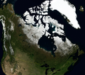
فَیِل:Canada BMNG.png
Appearance

نُمٲشِہ ہُنٛد ناپ: 678 × 599 پِکسَل باقی ریزولوشَن: 272 × 240 پِکسَل | 543 × 480 پِکسَل | 869 × 768 پِکسَل | 1٬159 × 1٬024 پِکسَل | 2٬185 × 1٬931 پِکسَل
اَصلی فَیِل (2٬185 × 1٬931 پِکسَل، فَیِل ناپ: 6٫28 میگا بایِٹ، MIME قسٕم:image/png)
فَیِل تَوٲریٖخ
فَیِل وُچھنہٕ باپتھ کٔریو کلک تأریخ/وقت پؠٹھ تاکہِ یہ گژھِ تمہ وقتہٕ ظٲہر
| تٲریٖخ/وَقت | تھمب نیل | پہلوٗو | صٲرِف | کَتھ | |
|---|---|---|---|---|---|
| موجودٕ | 18:41, 23 اَپریل 2006 |  | 2٬185 × 1٬931 (6٫28 میگا بایِٹ) | Hautala | {{PD-WorldWind}} Satellite image of Canada in June 2004. Screenshot from NASA World Wind, Blue Marble Next-Generation layer. Category:Satellite pictures of Canada |
فَیِلٕ ہُند اِستِعمال
یہِ صَفہٕ چھُ اَتھ فَیِلہِ اِستِمال کَران:
فَیِلہٕ ہُنٛد عالمِی اِستِمال
دِنہٕ آمٕتیٚو باقٕی وِکیٖیَن منٛز چھےٚ یہِ بٕہی استعمال سپدان:
- arz.wikipedia.org پؠٹھ استعمال
- ast.wikipedia.org پؠٹھ استعمال
- atj.wikipedia.org پؠٹھ استعمال
- ca.wikipedia.org پؠٹھ استعمال
- dag.wikipedia.org پؠٹھ استعمال
- da.wikipedia.org پؠٹھ استعمال
- de.wikivoyage.org پؠٹھ استعمال
- diq.wikipedia.org پؠٹھ استعمال
- el.wikipedia.org پؠٹھ استعمال
- en.wikipedia.org پؠٹھ استعمال
- eo.wikinews.org پؠٹھ استعمال
- eo.wikiquote.org پؠٹھ استعمال
- fi.wikipedia.org پؠٹھ استعمال
- fr.wikivoyage.org پؠٹھ استعمال
- ga.wikipedia.org پؠٹھ استعمال
- gd.wikipedia.org پؠٹھ استعمال
- gl.wikipedia.org پؠٹھ استعمال
- gpe.wikipedia.org پؠٹھ استعمال
- ha.wikipedia.org پؠٹھ استعمال
- haw.wikipedia.org پؠٹھ استعمال
- ia.wikipedia.org پؠٹھ استعمال
- ig.wikipedia.org پؠٹھ استعمال
- incubator.wikimedia.org پؠٹھ استعمال
- it.wikipedia.org پؠٹھ استعمال
- kab.wikipedia.org پؠٹھ استعمال
- kcg.wikipedia.org پؠٹھ استعمال
- kl.wikipedia.org پؠٹھ استعمال
- nqo.wikipedia.org پؠٹھ استعمال
- pag.wikipedia.org پؠٹھ استعمال
- tl.wikipedia.org پؠٹھ استعمال
- vec.wikipedia.org پؠٹھ استعمال
- www.wikidata.org پؠٹھ استعمال
- Q16
- User:GerardM/Nansen Refugee Award
- User:Zygimantus/Wikidata lists/Example2
- Wikidata:List of 1000 articles every Wikipedia should have
- Wikidata:WikiProject sum of all paintings/Top work locations
- User:Spinster/ASC Leiden Thesaurus
- Wikidata:WikiCite/Wikidata lists/Main subjects of publications with unidentified authors
- User:Walkuraxx/ASC Leiden Thesaurus
- Wikidata:WikiProject sum of all paintings/Location missing administrative territorial entity

