
فَیِل:Jammu and Kashmir locator map.svg

Size of this PNG preview of this SVG file: 764 × 600 پِکسَل. باقی ریزولوشَن: 306 × 240 پِکسَل | 611 × 480 پِکسَل | 978 × 768 پِکسَل | 1٬280 × 1٬005 پِکسَل | 2٬560 × 2٬010 پِکسَل | 2٬160 × 1٬696 پِکسَل
اَصلی فَیِل (SVG file, nominally 2٬160 × 1٬696 pixels, file size: 679 کِلوبایِٹ)
| عُنٛوان |
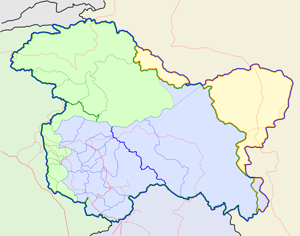
Jammu and Kashmir locator map |
||
| Description |
Locator map for the state of w:Jammu and Kashmir |
||
| تٲریٖخ | |||
| آگُر |
پَنٕنؠ کأم |
||
| تَخلیٖق کَرن وٲلؠ |
|
||
| اِجازَت (دۄبارٕ یہِ فیل استعمال کرٕنی) |
I, the copyright holder of this work, hereby publish it under the following license: یَمہِ فَیِلہِ ہٕنٛز لاسَن چھِ Creative Commons Attribution-Share Alike 3.0 Unported تَحَت یِوان۔
|
||
| Geotemporal data | |||
| Date depicted | second half of 20 century تہٕ 21 century | ||
| Georeferencing | If inappropriate please set warp_status = skip to hide. | ||
| Archival data | |||
| نوٹ | Part of WikiProject India Maps | ||
فَیِل تَوٲریٖخ
فَیِل وُچھنہٕ باپتھ کٔریو کلک تأریخ/وقت پؠٹھ تاکہِ یہ گژھِ تمہ وقتہٕ ظٲہر
| تٲریٖخ/وَقت | تھمب نیل | پہلوٗو | صٲرِف | کَتھ | |
|---|---|---|---|---|---|
| موجودٕ | 10:31, 6 اَکتوٗبَر 2020 | | 2٬160 × 1٬696 (679 کِلوبایِٹ) | Hindian1947 | Fixed colour |
| 10:26, 6 اَکتوٗبَر 2020 |  | 2٬700 × 2٬120 (153 کِلوبایِٹ) | Hindian1947 | Ladakh, Gilgit Baltistan borders fixed | |
| 18:00, 9 اَپریل 2007 |  | 2٬160 × 1٬696 (211 کِلوبایِٹ) | Planemad | {{WikiProject_India_Maps |Title=Jammu and Kashmir locator map |Description=Locator map for the state of [w:Jammu and Kashmir]] |Source= [http://www.koausa.org/Nature/maps.html Map of Kashmir], |Date=April 2007 |Author=w:user:Planemad }} [[Category:W |
فَیِلٕ ہُند اِستِعمال
یہِ صَفہٕ چھُ اَتھ فَیِلہِ اِستِمال کَران:
فَیِلہٕ ہُنٛد عالمِی اِستِمال
دِنہٕ آمٕتیٚو باقٕی وِکیٖیَن منٛز چھےٚ یہِ بٕہی استعمال سپدان:
- ar.wikipedia.org پؠٹھ استعمال
- bn.wikipedia.org پؠٹھ استعمال
- bpy.wikipedia.org پؠٹھ استعمال
- ceb.wikipedia.org پؠٹھ استعمال
- de.wikipedia.org پؠٹھ استعمال
- en.wiktionary.org پؠٹھ استعمال
- fa.wikipedia.org پؠٹھ استعمال
- gu.wikipedia.org پؠٹھ استعمال
- hi.wikipedia.org پؠٹھ استعمال
- साँचा:ज्ञानसन्दूक भारत के क्षेत्र
- साँचा:ज्ञानसन्दूक भारत के क्षेत्र/doc
- अनंतनाग लोक सभा निर्वाचन क्षेत्र
- बारामूला लोक सभा निर्वाचन क्षेत्र
- जम्मू लोक सभा निर्वाचन क्षेत्र
- लद्दाख लोक सभा निर्वाचन क्षेत्र
- श्रीनगर लोक सभा निर्वाचन क्षेत्र
- उधमपुर लोक सभा निर्वाचन क्षेत्र
- शारदापीठ
- रिमो मुज़ताग़
- Module:Location map/data/Kashmir
- Module:Location map/data/Kashmir/doc
- हाजी पीर की लड़ाई
- शाह मीर राजवंश
- id.wikipedia.org پؠٹھ استعمال
- it.wikipedia.org پؠٹھ استعمال
- ja.wikipedia.org پؠٹھ استعمال
- mai.wikipedia.org پؠٹھ استعمال
- ml.wikipedia.org پؠٹھ استعمال
View more global usage of this file.